
- Видео 98
- Просмотров 2 488 130
Practical Navigator
США
Добавлен 7 мар 2013
Practical Navigator Training is designed to present useful navigation topics for professional and recreational mariners in a no-nonsense way. The site is run by Christopher D. Nolan, a former USCG cutterman and current merchant mariner in the sail training industry. Chris has over 14 years of sea time, with 10 years in command. He holds a 1600-ton USCG merchant mariner license upon ocean routes and a 3000-ton STCW license.
Dip of the Sea, Short of the Horizon Table for Celestial Navigation Close to Land
Can you practice celestial navigation on lakes or other inland waters? You betcha.
You might just need to apply a Dip of the Sea Short of the Horizon correction! In this video we will show the Bowditch table and how to make the correction place of your normal Dip correction for height of eye.
Here is a dip short calculator from Starpath School of Navigation: www.starpath.com/calc/Distance%20Calculators/dip.html
Here is the Bowditch Tables: thenauticalalmanac.com/Bowditch-%20American%20Practical%20Navigator.html
Просмотров: 1 990
Видео
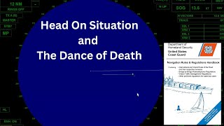

The Dance of Death in a Head On Situation
Просмотров 1,5 тыс.11 месяцев назад
In the Collision Avoidance Regulations (COLREGS), otherwise known as the Rules of the Road, Rule 14 describes how vessels who are meeting in a head on situation should act (they should alter course to starboard and pass port to port). However sometimes it is not straight forward, and there is doubt about risk of collision. This can sometimes lead to the "dance of death" in which one vessel thin...
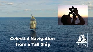
Evening Star Celestial Navigation (Jupiter and Polaris) Sight Reduction from a Tall Ship
Просмотров 4,6 тыс.Год назад
We are underway aboard the 134 foot tall ship Corwith Cramer, and we take evening star observations of Jupiter and Polaris with a sextant, and then we do all the math to reduce them to a fix using the techniques of celestial navigation. Two quick notes: the watch time was actually 20 seconds fast, not slow, sorry for mis-stating that. The math is correct though. And I skip the GHA increments fo...

3rd Mate Chart Plot Sample Exam (2023)
Просмотров 5 тыс.Год назад
The new 3rd mate chart plot exams have been causing some hate and discontent in the fleet - in this video I solve all the sample exam questions and provide some thoughts and strategies on the exam process. You can find NMC Sample exams for all exam topics at this link: www.dco.uscg.mil/nmc/exams/deck_officer/ This specific sample exam might be replaced in the future. You can find the entire exa...

The Vectormaster, Winds, and Maneuvering Boards
Просмотров 6 тыс.2 года назад
This video describes how to calculate the true wind based on your ship's course and the relative wind, using a maneuvering board or a vectormaster. This video is mostly for my tall ship crew and students at www.sea.edu but might be helpful for others too! For more on maneuvering boards please see my maneuvering board series here on RUclips. ruclips.net/video/8YUic4LdWFg/видео.html Vectormaster ...

Great Circles and the Alabama Stone
Просмотров 2,2 тыс.2 года назад
Great Circle Sailing is a type of problem found on Oceans Navigation Exams for the U.S. Coast Guard. This is a brief introduction to Great Circle math without getting into too much of the theory. The definition of a Great Circle is the intersection of the surface of a sphere and a plane through the center of that sphere. In other words, longitude lines are great circles, the equator is a great ...

Celestial Navigation Time zone Lingo for U.S. Coast Guard Exams
Просмотров 4,3 тыс.2 года назад
Specifically for U.S. Coast Guard exams there is often confusion over the lingo used for time zones and zone descriptors. This video describes standard meridians, zone descriptors commonly used in USCG exams, and the reasoning behind solving these problems. For more reading, refer to Bowdtich's chapter on "Time" which you can download for free from the NauticalAlamanac website thenauticalalmana...
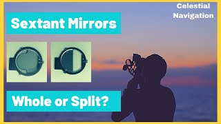
Whole Horizon vs. Split Horizon Sextant Mirrors
Просмотров 7 тыс.2 года назад
Should you get a sextant with a whole horizon mirror or a split horizon mirror? Either one is great, but this video shows you a few of the differences in the two main types of horizon mirrors you can use for celestial navigation. This video features a Celestaire Astra IIIB sextant and portions of the video were filmed underway on Sea Education Association's ship the Corwith Cramer (www.sea.edu).

Why Would You Use a Sextant Upside Down? #VeritasiumContest
Просмотров 4,5 тыс.2 года назад
#VeritasiumContest @veritasium A sextant is a device using two mirrors which can be manipulated to measure the angle between any two objects. We often use the sextant for celestial navigation to measure the angle between an object in the sky such as the Sun, Moon, Planets, or stars and the local horizon. Using this angle, the time, and a set of navigational tables, we can help determine our pos...
Sextant to Line of Position - A Complete Sight Reduction from an Offshore Sailing Race
Просмотров 37 тыс.3 года назад
I recently returned from a sailing race and along the way I took some Sun Sights using a sextant with my friend Chuck. In this video, we will reduce one of the sights from beginning to end. We'll cover all the celestial navigation theory and math required to take a sextant reading to a usable line of position on a chart. The five main steps are: 1: Observe and correct the sight. 2. Find the geo...
Do These Spell Anything? Pub 102 and Full Dress Ship
Просмотров 10 тыс.3 года назад
Flag and pennant meanings are described in Pub 102 which is available here msi.nga.mil/Publications/ICOS Generally speaking, Full Dress Ship flags are arranged in a certain order according to NTP 13B, and the order does not translate into anything particular. Civilian vessels are not held to this standard and my arrange the flags in other order. Regardless of Full Dress guidance, Pub 102 is a g...
Speed, Distance, and Time for Maritime Navigation
Просмотров 24 тыс.3 года назад
This is an introductory-level video about speed, distance, and time calculations used by marine navigators. This is a good lesson for elementary and middle school students just learning algebra to see a practical use of those math skills. It is also good for professional navigators interested in refreshing their skills before exams. Speed is equal to distance divided by time. Time is equal to d...
What Does a Pilot Chart Have to do with Marine Navigation?
Просмотров 5 тыс.3 года назад
When you hear the word pilot chart you probably think of something to do with aviation. Not so. Some Links to Check Out: Cornell's Ocean Atlas - amzn.to/3aqHX1n World Cruising Routes - amzn.to/3s3LbxT Free Pilot Chart Download from USA Government - msi.nga.mil/Publications/APC Printed Pilot Charts (Maryland Nautical) - mdnautical.com/501-atlas-of-pilot-charts Maury Wikipedia Page - en.wikipedia...
How Far Can You See a Light? Assuming the Earth is not Flat....
Просмотров 3,8 тыс.3 года назад
The visibility of a light at sea depends on the three main factors, and you can use this information to navigate a ship or to pass an exam. In this video we discuss Geographic Range, Nominal Range, and Luminous Range of lights, including how to use that information at sea. For lots of free and discount courses, visit www.practicalnavigator.org 0:00 Introduction 0:28 Luminous Range 0:41 Geograph...
Transatlantic: A Voyage of Discovery (Sailing USA to Ireland in a tall ship)
Просмотров 60 тыс.4 года назад
Many people have asked me about the work I do with SEA Semester, where I sail as a tall ship captain and educator in semester-long programs at sea. This is a film (my first real film!) made during a Transatlantic crossing aboard the Sailing School Vessel Corwith Cramer. We sailed from Woods Hole, Massachusetts to Cork, Ireland. It was a great journey! The film won the "Grand Prize" at the Inter...
USCG Problem Solving (Basic Stability and Deck Safety)
Просмотров 5 тыс.4 года назад
USCG Problem Solving (Basic Stability and Deck Safety)
Should You Get a Plastic or Metal Sextant?
Просмотров 24 тыс.4 года назад
Should You Get a Plastic or Metal Sextant?
Navigating to an Uncharted Volcano in the South Pacific
Просмотров 5 тыс.4 года назад
Navigating to an Uncharted Volcano in the South Pacific
How To Be More Accurate With Chart Plotting Tools
Просмотров 24 тыс.4 года назад
How To Be More Accurate With Chart Plotting Tools
How do ships navigate around hurricanes?
Просмотров 16 тыс.4 года назад
How do ships navigate around hurricanes?
Top Five Rules of the Road Mistakes Boaters Make
Просмотров 16 тыс.4 года назад
Top Five Rules of the Road Mistakes Boaters Make
Navigation General Sample Exam (Questions 47 to 50)
Просмотров 1,6 тыс.5 лет назад
Navigation General Sample Exam (Questions 47 to 50)
Navigation General Sample Exam (Questions 41 to 46)
Просмотров 1 тыс.5 лет назад
Navigation General Sample Exam (Questions 41 to 46)
Navigation General Sample Exam (Questions 35 to 40)
Просмотров 1,2 тыс.5 лет назад
Navigation General Sample Exam (Questions 35 to 40)
Navigation General Sample Exam (Questions 32 to 34)
Просмотров 1,3 тыс.5 лет назад
Navigation General Sample Exam (Questions 32 to 34)
Navigation General Sample Exam (Questions 28 to 31)
Просмотров 1,3 тыс.5 лет назад
Navigation General Sample Exam (Questions 28 to 31)
Navigation General Sample Exam (Questions 22 to 27)
Просмотров 1,2 тыс.5 лет назад
Navigation General Sample Exam (Questions 22 to 27)
Navigation General Sample Exam (Questions 17 to 21)
Просмотров 1,6 тыс.5 лет назад
Navigation General Sample Exam (Questions 17 to 21)
Navigation General Sample Exam (Questions 13 to 16)
Просмотров 1,2 тыс.5 лет назад
Navigation General Sample Exam (Questions 13 to 16)
Navigation General Sample Exam (Questions 9 to 12)
Просмотров 2,4 тыс.5 лет назад
Navigation General Sample Exam (Questions 9 to 12)
Nice learning with you, I have one and studying trigonometria
Can you calculate the assmiths of sunrise and sunsets through the years.
I wish I had known this years ago 🙀
Simply the Best !... a Guru in this subject and a master in its delivery.... thank you !
Fantastic easy explanation
"..if you believe in that sort of thing..." 😂😂
the graphics, explanations, and definitions are very well articulated. Thanks!
thanks, brushing up on old skills. Lahaina noon is tomorrow here on Maui. I'm going out at noon and using my flagpole to find my latitude here in Haiku. thanks,
What a relief , the confusion and doubt I had have finally been resolved. Thanks for your absolutely amazing explanation. Cheers🫡
Absolutely brilliant presentation, a real ‘Ahaaaaaa I get it now’ moment for me! Apart from the 90deg to 89deg60 trick.🤷♀️
Third video I've watched on the sextant so far and the best. I like how it gets to the basic idea of what you do and what you see etc. I knew nothing about it 10 minutes ago now I got a rough idea. I wanted to research after seeing Robert Redford use one in All is Lost. Next thing I wanna look up is, how do you take those measurements and apply them to a map? I guess there is a video on that also. I will look.
Chris has a video where he demonstrates the process of converting an observed altitude into an intercept.
You are simply the best tutor in this field...absolute GURU.... thank you for your brilliant work !
That was without doubt the best explanation I've seen so far and the order of flow very well presented.
Excellent teacher!
EXCELLENT instruction Chris. I have a lot of difficulty going from printed material only to comprehension. This just clarified a lot and I will save this vid for ongoing reference. I'm hoping to be a student of yours at some point in the near future. Mahalo!
Good except the music
really excellent thank you
Google's Gemini A.I. recommended me this video, As i am talking about universe and solar system
Use sharp skinny lead and spin your pencil and draw lightly and erase nicely …a clean plot is a happy plot 😂…and know your ‘station peculiarities’
Phenomenal video. The best celestial video I’ve ever seen.
Awesome instructions sir
Great video, I really enjoyed it. Oddly satisfying to watch you work through each problem. Not gonna lie, looks crazy difficult
And then once the sun is on the horizon.... Then how does THAT tell you where you are, OR how far you've gone? As I've heard pirates and the navy use this from 1758 ish
Some really smart people figured this out. Especially those in olden days. It blew my mind just watching this. Great job explaining but WOW.
excellent usage of the dual markers stacked in a composite unit used for pointing! +1 sir
Nicely done. Thanks
A simple question, Do you need to factor in Equation of Time to figure things like Time of Phenomenon - sunset and so forth ? OR are the daily page times already adjusted for us ? Thanks in advance for advice on this.
Chris has three videos dealing with basic, intermediate and advanced concepts of time. Very informative.
@@marcg1686 Thanks. I've been over these a few times but Equation of Time doesn't get a mention except to say it is included in the Daily pages box, page bottom alongside Sun and Moon transit times. What I have "worked out" for myself is this: taking an example from today's entry - Meridian Passage given as 1205 UT and EoT for Noon as negative 04':54". It seems plain that 6 seconds have been rounded off. For tomorrow (March 29th. 2024) the rounding is 24". This practice is evident in the Nautical Almanac for all recent years. I was a bit thrown when there is otherwise insistence on time keeping precise to the second. In the NA Auxiliary & Planning Data para.18 (page 260 in UKHO volume for '24) advice is given to adjust mean time by applying EoT. No mention that the time of Meridian Passage is perhaps already adjusted. It is I think a Grey area. I make solar compasses of the Bagnold type and prepare setting tables for these. It's a historic feature of these that individual operators make their own adjustment calculations for LAN at their DR position. The values for this (EoT) are taken from the Analemma. PS Are you The Captain Marc attending the past Sailings online classes ? If so Greetings. Many Thanks for the input 👍🏼
How does the second matter when it takes several seconds from when you are done with the reading and have written it down after looking at your watch?
You look at your watch first. The reading stays on the sextant if you don't move the arm.
Thanks, great video
Just passed the dreaded chart plot using this guys videos on his website. Best videos for this topic hands down.
Congratulations!!
Awesome job. Thank you
I searched how the stat tracker on the SR-71 worked... It's been quite the rabbit hole and now here I am!
I would like to thank you for the videos...I am sitting for Exams and I found them very helpful. All the best to you. Thank you again
Nice video, I'm retired from merchant marine, but teach ratings the basics of navigation
LHA is important when you're trying to fit all of the tables required to do this into a single book.
No offence, but I don't understand the point you're trying to make. If you use HO229 or HO249 Volume 2 and 3, the entry arguments are Lat, Dec and LHA. If you use HO249 Volume 1 the entry arguments are Lat and the LHA of Aries. The LHA is a prerequisite.
@@marcg1686 That is my point. With LHA you can constrain the number of possible triangles that need to be pre-computed down to something manageable. Very clever.
Nice video. I am going to to learn this. It got me thinking how the sentiment these days is that we've left the entire past in the dust with the computer age. I can rarely get someone under 35 or so to be interested in anything not "techy". But can you imagine the minds the developed a technology like this. If I understand correctly it is accurate to within 1nm. The first sextant dates to around 1759. what is that, 264 years? I find that just amazing. No batteries or connection required. A beautiful, to me, tool and a book. And a brain.
I was curious how this is done. This is the 3rd and easiest, although not easy, instruction I’ve watched. It is not clear to me after you take this measurement - how do you know where you are?
Another great video. I'm not sure why I took so long to subscribe to this channel.
On one hand @NathanOakley1980 wants to ridicule your expertise, but then uses you as a reference to claim that the sextant saves lives and that your methods prove the earth is flat!! Though he has never used a sextant, ever, just says his sister did! #WhereIsNathansSister
You needn't have a sextant to understand celnav. 10thman has a sextant, yet has never used it and completed a sight reduction.
😂 exactly! None of you have used the tools!! Where is 10th man by the way? Left the sinking ship?
@@Elder-Bear I'm not a flat earther. I have several sextants. I do understand how celnav works.
@NathanOakley1980 seems to be trying to debunk your expertise, yet he has Never used a sextant, that's a strange position to take isn't it?
I am not a flat earther either.
DEAR BLACK JEHOVAH GOD LUCIFERIAN JIREH...(EYE-(666) SHED TEARS WITH & DIED FOR ALL DEMONS!!! TO THE (👁️-(666)-👁️$) OF DIVINATION (👁️-(666)-👁️) WILL NEVER BE A PRISONER OF TIME!!! (WE-(666) ARE NOT EQUAL!!! JESUS CHRIST IS NOT ALMIGHTY GOD...(👁️-(666)-👁️) ALONE AM & WILL ALWAY$ BE!!! THE UNIVER$E I$ THE HOU$E OF THE BLACK DRAGON-(666!!!) LEAVE ALL THE (DYNA$TIE$-(666) TO (ME-(666)...FLYING OVATION$-(666) & UNIVER$AL BLACK DIA$PORA-(666) FOREVER MANE!!! DEATH TO ALL 3 AMERICAS 🌎🌎🌎 FOREVER MANE!!! NEW JERU$ALEM-(666)/BLACK-DRAGON'$VILLE-(666) IS ALL MINE$ ONLY!!! NIGERIAN NECTAR I$ $TILL (MY-(666) $EXLECTION!!! WAKANDA-(666) WILL BE A WHOLE PLANET... WILL BE A WHOLE GALAXY... WILL BE A WHOLE... UNIVER$E-(666)!!! CANNIBALI$TICALY, UNIVER$ALLY & LUXURIOU$LY IMMORTALIZE ME'NE ME'NE TEKEL 100% BLACK DRAGON'$ $PIRITUALETICI$M-(666) FOREVER MANE!!!
Assuming that you are using a sextant, you have an elevation angle of 50 degrees for the Sun as you are viewing it through the sextant. With the sextant horizon mirror, you bring the sun down to the horizon (sea level), mark the time when the sun just touches the horizon line, and use that time mark and degree to find out about the position of the Sun at a given time. If your eye level is above the sea level you have to do dip correction to the sea level! It is in the book Navigation Almanac, which contains all the information about the position of all celestial bodies at a given time. Okey, you have 50 degree siding (elevation angle) of the Sun and 180 degrees baseline following the surface or the sea level to the horizon,or GP (named ground position) That gives you 90 degree right angle triangle to the sun. Now you subtract from the 90 that 50 and you get 40, 40 times 60 nautical miles, you're 2400 nautical miles away from the GP, to the sun. It can never happen on a globe with radius of 3959 miles. It's A circle of equal altitude around the GP, and means you have a flat area of 360 degrees, 2400 miles of equal altitude. It is necessary to repeat the procedure 1-2 times so that your other circles of equal altitude can intersect one another. On the chart, it will show your position on the earth. Use it to plot your way! that's how celestial navigation is performed. The known area of the earth is definitely Flat so far we know!
Well that isnt how celestial navigation works and you have sevetal flaws in your new way of doing it. Where do you get 60 nautical miles from? 60 nautical miles per degree is incompatable with a flat earth. The distances between lines of longitude wouldnt work. Right angle triangles aren't used in celestial navigation, but if you claim we can make one to the sun then i feel bad for those poor people being roasted at sun set. Way to many holes, back to the drawing board.
@@iveneverseensuchbehaviorin5367 I am still waiting for Jon, Any of Joakley's disciples, or any other Flerf to show me the derivation of the dip angle corrections in the nautical almanac (which they all agree are correct) WITHOUT using the Earth's radius. Going on 2 months now and no takers!
Circles of equal altitude only work on a globe, literally on a globe. They don't even work on the charts that navigators use. Why are there no maps available that show the flat earth?
@@marcg1686 OMG! Is it necessary for me to answer this nonsense? The surface cannot be spherical if there are circles of equal altitude over it!
@@JonBernhards66 I've an idea. I'll post three observations with the GPs of the celestial bodies observed and you plot them on a flat map and post a photo of the result to your Community tab. Think you're hard enough?
Nice flat earth proof. The mental contractions you use to convince yourself to ignore your own cognitive dissonance are incredible.
well with zero evidence and zero understanding of how celestial navigation works we'll just have to ignore you until you grow up.
@@iveneverseensuchbehaviorin5367 clearly if our understanding of celestial navigation comes from this video with the fictious modeling of angles from curved adjacents then we would all be lost at sea
@@njappboyUntil you come up with an alternative to the sight reduction process as has been employed for the last two hundred years, we'll just go with a globe with a mean radius of 3440.1 nautical miles.
@@marcg1686 stick with pretending you live on a ball and watch those government agency's computer generated images. "Sweet dreams are made of these...some of them wanted to be abused"
@NathanOakley1980 said you were speaking nonsense in his recent 2038 show. They said you use angles from hell and that you would get people Lost at Sea!!
Nathan couldn't navigate his way out of a paper bag.
Deep down you know this insertion of assumed curvature is pure cognitive dissonance. Sure, if land is too close to you there can be a correction to adjust for the horizon. This has zilch to do with Earth curve and you both know it. Even the claim made of exaggerated curvature in the video is stated with hesitation. This is a purposeful slight at the fear of FE.
@@LBBstore My fear of FE is matched only by my fear of being savaged by a moist lettuce leaf. Until you explain how you would apply the dip correction on your space fritatta, we'll just go with a globe that has a mean radius of 3440.1 nautical miles.
@@marcg1686 Are you nuts? The dip correction is done based on the observer height to ensure the line from the observer to the horizon is PARALLEL with the FLAT WATER from observer to horizon to the GP of the star! If you are at an elevation of 0 THERE IS NO DIP CORRECTION. Again, if you lie you do realize you will be called out to show your claims in diagram form and once exposed you will never ever be trusted again! At 0 elevation there is NO dip correction…SHOW THE DIAGRAM of what is being done!
@@marcg1686 Are you stating it is not possible to remove the depression angle after taking an elevation angle with a Mariner’s sextant on a flat Earth? That would be an outright LIE… From Maritime Org: The correction is referred to as DIP and must always be subtracted from the observed altitude. In order to find the value of dip, the nautical tables must be entered with the height of eye of the observer above the sea surface. Once applied the observed altitude becomes the “apparent altitude” - Ok, so you remove the depression angle and correct your angle to ensure your baseline is PARALLEL with the horizon.. What’s the problem? You do realize if you lie you will be called out and exposed.
It's Flat! and the sailors/navigators did that according to Flat reality!!!!
You're living on a globe. We've checked.
Excellent tutorial and links. Keep up the good work!!!
Hahahaha “let’s imagine that the earth is flat” The earth has to be flat to do celestial navigation. There are no right triangles on a sphere. This guy uses techniques as if the earth were flat because it f***ing is. A spherical right angle triangle is a contradiction in terms. This guy only treats the earth as if it is flat when navigating with the stars. He keeps having to beat it into everyone’s head that the earth is round because celestial navigation requires a horizontal plane of reference. It is laughable.
Hey Willy, you think Earth is flat. Prove it. Solve this celestial navigation problem using flat earth only. Should be easy. No flat earther will touch it, they all run away, deflect or give excuses. What will you do? Here are 2 real Sun sights. Find the observer's position. 1st Sun sight: February, 20 2010 17:26:26 UTC (GMT) Sextant: 40°18.2' Artificial horizon Sextant error: 0.0' Upper limb of the Sun 2nd Sun sight: February, 21 2010 00:16:02 UTC (GMT) Sextant: 24°04.4' Artificial horizon Sextant error: 0.0' Lower limb of the Sun No cheating now, you can't use globe science, only ''flat earth science''. Show all your calculations.
Oh btw there is no spherical right angle triangle when we take a sextant sight, in fact there is not even any kind of triangle in a sextant sight. The line of sight from the observer to the star is parallel to the line from the GP to the star so there is no triangle. There is only an angle between the horizon and the star. A spherical triangle exists in Celestial Navigation but it's a triangle on the surface of the globe as shown starting at 42:48. He beats it that Earth is a globe only for flat earthers that haven't figured yet that Earth is not flat, normal people already know that Earth is a globe. So when can I expect your flat Earth Celestial Navigation demonstration?
Nothing? I'll take it as it's imposssible to do flat earth celestial navigation.
Given your beliefs it's clear that you have the mind of a gold fish. Skip to 54:00 and try to identify the 'spherical right angle triangle'. Dunce.
" It is laughable." Yep it certainly was. You ran as far as you could. Zero attempt to make your point. (but truth be told you held a losing hand).
I had a bad experience with DAVIS. I bought a new M15 sextant (on eBay) and the lens came loose from the 3X telescope. There was no way to fix it. I sent an email to Davis, including photos, and got no response. I sent it again and was told that customer service would respond. The answer came after I insisted, once again, and was "we don't have stock of this part. I asked for more information and no answer. They totally ignored me. So, a serious company is one that cares about the customer and this was not the Davis case with me.
So angles on a level surface? Seems there are a lot of straight lines being used on an alleged curved surface lol
Level follows the curvature of the earth. Celestial navigation is created with the earth being a sphere. Celestial navigation wouldnt work if the eath was flat. Celestial navigation works, therefore the earth is a sphere. Your comment is meaningless, but if you want to understand the error of your ways i can help you.
'...a lot of straight lines...' Only two. The curved line to the horizon, the dip correction takes care of that and the curved line to the celestial body that is being observed. The altitude correction takes care of that. None of you 'tards can demonstrate celestial navigation on a notional flat earth. Why is that?
Question to your Sextant experts. I am in need of an instrument that would allow me to determine the angle between two objects at a distance of 2 to 3 miles. If I were to turn a sextant horizontally? A cheap $50 sextant should be able to achieve this, otherwise it is going to cost thousands for a theodolite that I can't carry up into alpine environments anyway. Any thoughts that come to mind on what I should buy, and if this is possible in your opinion? I plan to transfer these angles to Google earth, and to then determine the GPS locations for objects at a distance that I can't get to because of terrain, ice, rock cliffs, and craigs. I know there are instruments that can do this, rangefinders and such, but I'm not going to spend 5k on a range finder, and then another 3k on a surveyors theadolite. I could hang plumb bobs at a distance in front of me, and from tripods to transfer the inclination between objects to two parallel plumb bob strings, and use the sextant to sight the two plumb bob strings in order to get the angle between the two strings. The plumb bob strings would be superimposed over the two objects at a distance. One object possibly the summit of a mountain, and the second object, located 1,500 in elevation below the summit. Again, the plumb bob strings would convert differences in elevation to two parallel lines that can then be read by the sextant as an angle. This would then be transferred to Google Earth, and the GPS location would be extracted.
How close are the two objects to one another? I have several sextants. Two Davis MK15s and several metal ones. Mostly Cassens and Plaths. A sextant will do the job but calibrating one for such close distances could be an issue. Parallax at short distances can be an issue.
Your idea should work but a bit of work is required on the position calculations if they are at different elevations. I have used my Davis 15 to measure the horizontal angles between three lighthouses in the bay near where I live. What I did was to get their location coordinates and use maths to calculate my position, a process known as resection. That was done in the old days by a three-armed device known as a "station plotter" probably used in the 8th and 19th century by sailors making charts of the coastlines. All good fun!
@@karhukivi Sory about my crappy initial post (no editing). Continuing to work on this project. Will be using some device thus summer when the snow melts. I'm currently looking at a surveyors compas. I may do testing across a river with GPS knowns and see how accurate I can get. If my accuracy is less than acceptable, I will move to some other device. I continue to believe the sextant would do the job well. 10 minutes of accuracy. A sextant with a calibrated compas may be how I will proceed.
@@TimKaseyMythHealer Interesting project - let us know if it works, good luck!
You're amazing!❤